
Too much water and not enough water can be problems in the same place, at the same time.
In October 2026, heavy rainfall across the Four Corners region forced evacuations, damaged homes, and closed roads. Yet the Colorado River Basin was still facing a persistent water shortage, with Lower Basin deliveries set to decrease by 1.25 million acre-feet annually in 2027 and 2028. The storms brought needed water, but they did not erase the conditions behind those reductions.
For utilities, agricultural water users, and land managers, the lesson is not simply to prepare for a wetter winter or another dry year. It is to plan for flood risk and water scarcity together.
A wet season arrives, and the ground can't absorb it
For most of 2026, the forecast for the Colorado River Basin carried a note of cautious optimism. A strong El Niño pattern, tracked by NOAA's Climate Prediction Center at greater than 90 percent probability through the winter, was expected to boost precipitation across the Southwest after years of below-normal snowpack. By late September, that signal was already showing up in the data: Colorado recorded above-average rainfall even as the state logged one of its warmest years on record, according to Colorado Politics' reporting on state climate figures.
Then, in the final week of October, the same atmospheric pattern that forecasters had welcomed as drought relief turned destructive. Days of heavy rain across the Four Corners region — where Arizona, Colorado, New Mexico, and Utah meet — sent the San Juan River to a crest of 21 feet in New Mexico, the highest level recorded there in nearly a century.
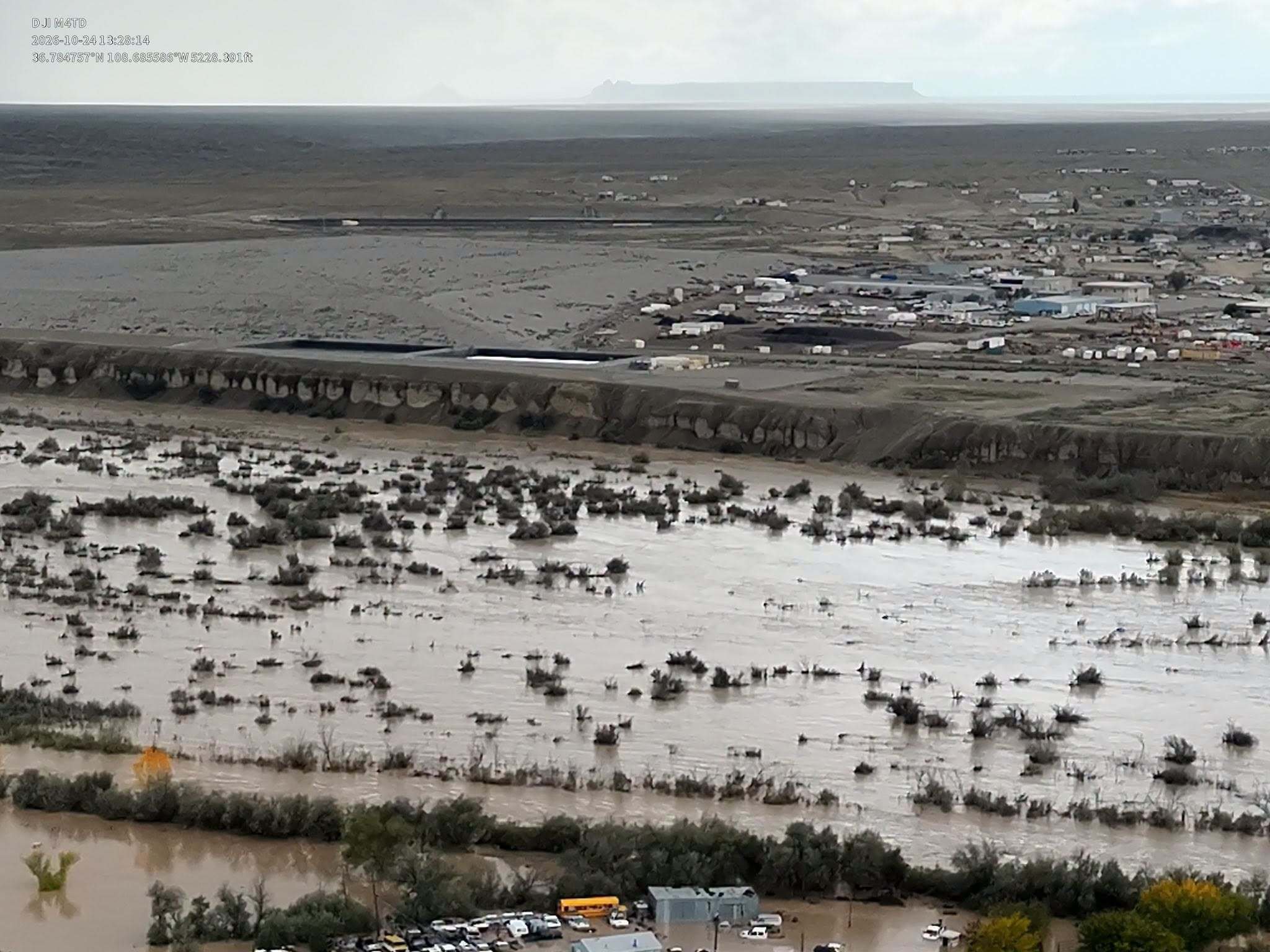
Four Corners flooding | October 2026 (Image courtesy of Tyrone Blackhorse)
Colorado's governor declared a disaster emergency across a dozen counties. In Hurricane, Utah, flooding damaged more than 100 homes and RVs. San Juan County, New Mexico, lost power to roughly 500 customers and saw downed lines and leaking gas lines alongside hundreds of water rescues. New Mexico's governor requested a federal emergency declaration and an initial $13.8 million in relief funding for San Juan County alone.
Forecasters pointed to the same El Niño pattern as a contributing factor. It is worth sitting with that for a moment: a weather pattern welcomed for its potential to ease drought also helped create conditions for destructive flooding.
The basin needed water. Its communities still had to survive its arrival.
Relief and damage are not opposites. They can be the same event.
This is the challenge water managers describe as hydrologic whiplash: a rapid swing between very dry and very wet conditions.
A flood can provide meaningful drought relief without resolving a structural water deficit built over decades. The October storms helped raise Lake Powell, but water officials cautioned that the improvement did not solve the underlying supply problem.
At the same time, high flows can create new problems, damaging infrastructure and moving sediment and debris through the watershed. That leaves communities managing several pressures at once:
-
Infrastructure must accommodate both extremes. Roads, culverts, levees, and intake structures need to function through low-water conditions and withstand damaging high flows.
-
Flood recovery includes water-quality concerns. Sediment, debris, and other contaminants can complicate recovery long after the water recedes.
-
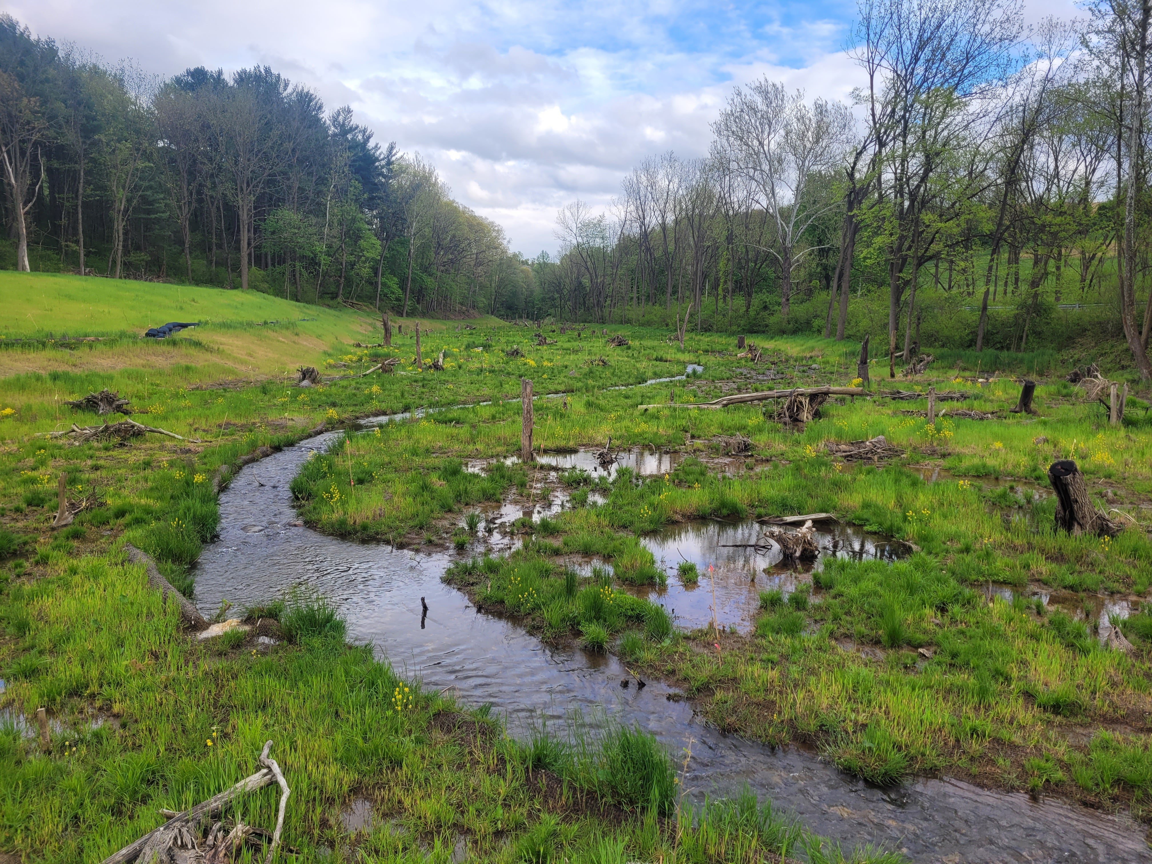
Ecosystem buffers can support both flood and drought resilience. Healthy floodplains, wetlands, and riparian corridors can slow and store water, helping moderate its movement through the landscape.
The question is not simply whether the rain helped. It is where it helped, what it damaged, and how much protection it provides against the next dry period.
Why this matters beyond one storm season
The Colorado River's foundational problem is a persistent mismatch between water demand and available supply. Prolonged drought, warming temperatures, and years of overuse have depleted the basin’s major reservoirs. One wet week does not erase those accumulated pressures.
Basin planning therefore must account for both ends of the range at once. Communities need protection from high flows while continuing to prepare for constrained supplies.
The federal option decision announced before the floods made that distinction especially clear.
Meanwhile, the structural cutbacks became official
Two months before the Four Corners flooding, the basin's underlying supply deficit was formalized at the federal level.
On August 21, 2026, Interior Secretary Doug Burgum approved new operating guidelines and a Record of Decision locking in Lower Basin cutbacks of 1.25 million acre-feet annually for 2027 and 2028. The framework also includes a target of at least 700,000 acre-feet in additional voluntary conservation and storage across the two-year period.
Arizona absorbs the largest share of the cut at 760,000 acre-feet, followed by California at 440,000 acre-feet and Nevada at 50,000 acre-feet.
The two-year framework provides long-term planning structure, but the longer-term agreement remains contested. For agricultural and municipal users, that means preparing for confirmed reductions while navigating uncertainty beyond 2028.
Reading the flood and the cutback side by side is the point. A basin can experience severe flood damage and operate under mandatory, multi-year supply reductions within the same season. Flooding and structural scarcity are not contradictory conditions, and neither can be planned for in isolation.
Where Nature-based Solutions fit
The response to hydrologic whiplash is not simply bigger pipes and taller levees on one end, or more storage on the other. It also involves restoring landscape features that help manage variability.
READ NEXT > Restore the stream, restore the valley StoryMap
Floodplain reconnection gives rivers room to spread during high flows where conditions allow. Riparian and wetland restoration can slow runoff and support water-quality improvement. Wetlands can also retain water and release it gradually, although their benefits depend on site and watershed conditions.
These approaches complement infrastructure and conservation. They do not replace either, and they should not be treated as a guaranteed source of additional usable supply. Their value is in restoring functions that help a watershed respond to changing conditions.
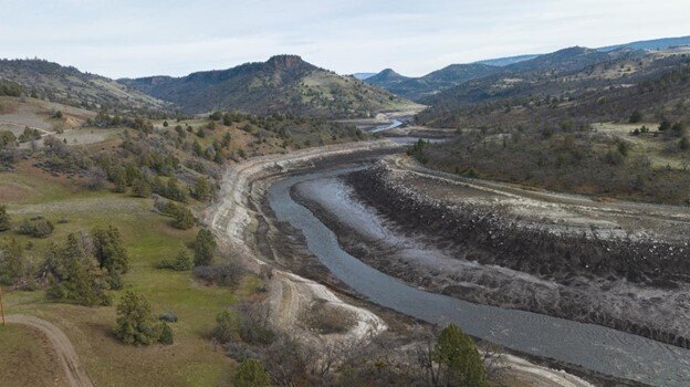
A free-flowing Klamath River post-dam removal.
RES has applied floodplain reconnection in other river systems, including through its work on the Klamath River Renewal project. Tributary restoration included reshaping streambanks to reconnect floodplains and installing features such as large wood and beaver dam analogs.
READ NEXT > Klamath River Restoration StoryMap
The Klamath is outside the Colorado River Basin, but the planning principle is relevant: consider the river and its surrounding landscape together, then design for local conditions.
For utilities, water districts, and land managers across the Southwest, that is the lesson the Four Corners offers: build for the whole range of outcomes, not just the one you were most recently worried about.
RES’ resiliency, advisory services, water quality, and dam removal & river restoration teams bring complementary expertise to this kind of whole-system planning, from evaluating floodplain reconnection opportunities to addressing water-quality concerns and conservation needs.
If your organization is reassessing watershed risk this winter, talk with a RES resiliency specialist about planning for both flood risk and water scarcity.