When it comes to flood resilience, small communities are often on the front lines, facing steep terrain, aging infrastructure, and increasingly severe storms. In Tazewell County, Virginia, local leaders are turning those challenges into opportunities for smarter, safer, and more sustainable growth.
Supported by Virginia’s Community Flood Preparedness Fund (CFPF), the City of Tazewell partnered with RES to launch a portfolio of flood resilience projects that reduce risk, restore natural systems, and strengthen infrastructure. These efforts stem from the 2023 Tazewell County Resiliency Plan, developed by RES and Stantec through extensive modeling, GIS analysis, and public engagement across the county’s most flood-prone areas, including Richlands, Bluefield, North Tazewell, and the City of Tazewell.
From plan to implementation
The plan identified more than a dozen priority projects through hydrologic and hydraulic (H&H) modeling and analysis of FEMA floodplain data. The first four CFPF-funded efforts are now moving from concept to implementation, combining gray infrastructure upgrades with nature-based design that stores, slows, and filters stormwater.Richlands School Area Stormwater Improvements
Awarded in 2024, this project targets chronic flooding near three schools—Richlands Elementary, Middle, and High—as well as surrounding businesses and residential areas. The design enhances stormwater conveyance through improved drainage, on-site retention basins, and reshaped channels that intercept runoff, thereby improving water quality. Using peak flow reduction modeling, the system provides greater capacity and on-site retention, ensuring safer access to critical community assets that also serve as emergency shelters.

Bluefield Flood Study and Drainage Enhancements
Also awarded in 2024, this project builds on a comprehensive flood study of the Beaver Pond Creek system, where frequent flash floods disrupt local businesses and threaten key public services, such as the Bluefield Fire Station.
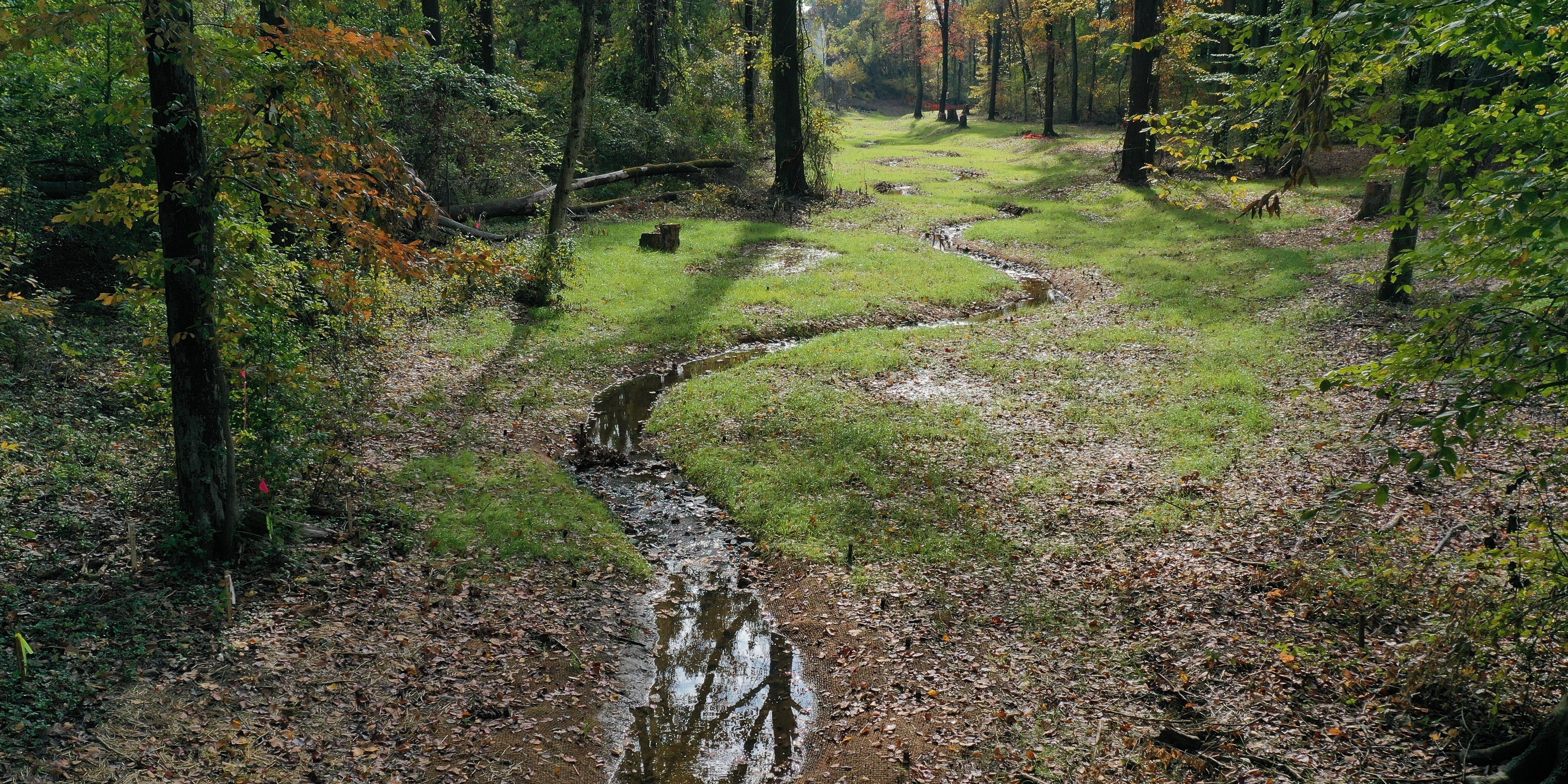
Using a 2D calibrated model, RES and the Town of Bluefield identified upstream flood storage opportunities, including stream and floodplain restoration within City Park. The proposed design integrates an overflow channel and a floodplain retention pond equipped with a continuous monitoring and automated control (CMAC) system to regulate storage and release after storms. Additional restoration along 3,000 linear feet of Beaver Pond Creek will reconnect the stream and floodplain, enhance habitat diversity, and create new recreational amenities, including trails around the restored area.

North Tazewell Debris Management and Stream Restoration
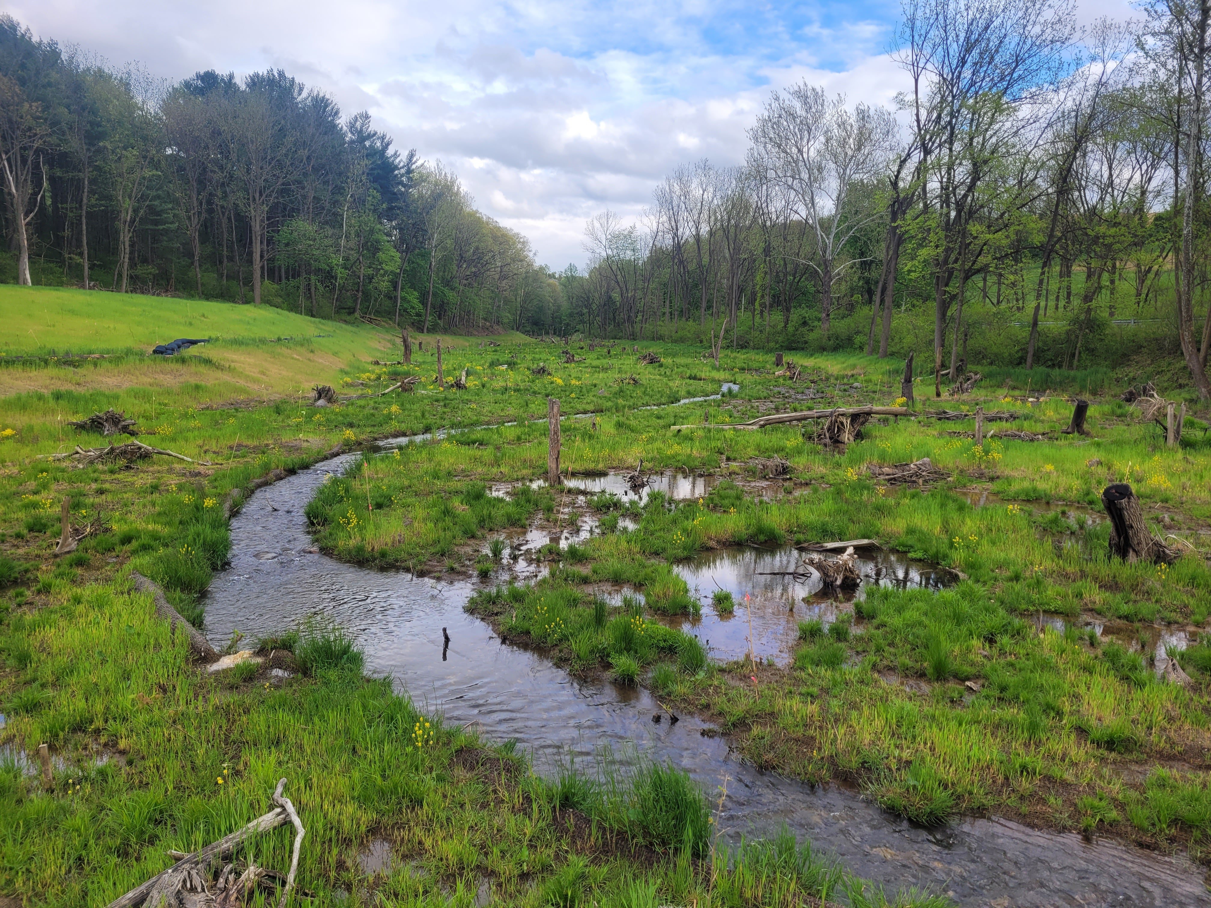
Heavy storm events have repeatedly overwhelmed stream corridors in North Tazewell, depositing debris and sediment that restricts flow. RES is combining debris removal, bank stabilization, and native vegetation replanting to restore channel stability, improve conveyance, and reduce future maintenance costs.
Bottom Road Flood Resilience Study
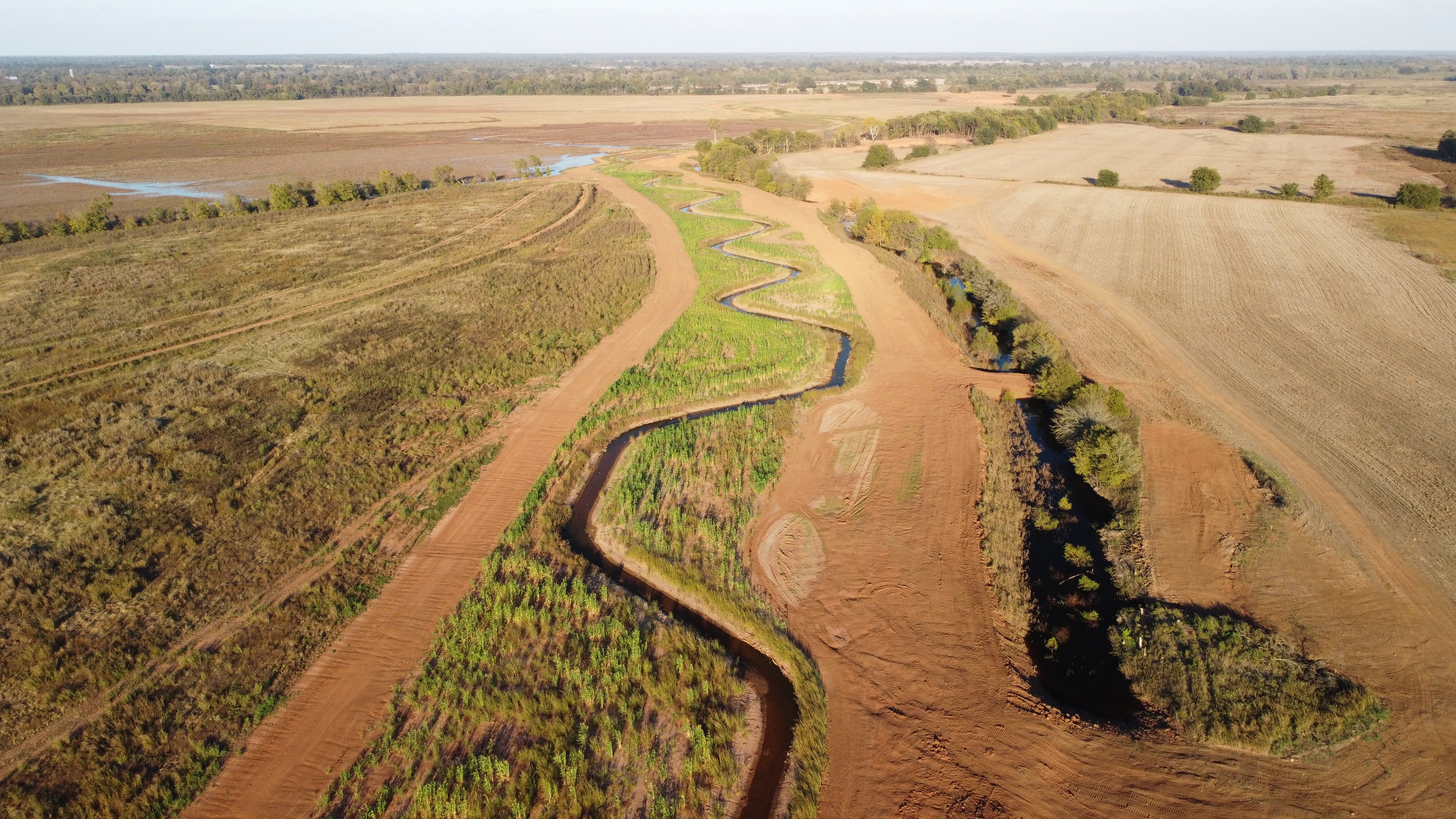
Along the Clinch River corridor, Tazewell County completed a flood study that proposes a mitigation solution expected to reduce 100-year base flood elevations (BFEs) by 2–3 feet for properties along Bottom and Raven Roads. Flooding in this area routinely isolates residents, overtops bridges, and damages mobile home communities. A 2D flood model and alternatives analysis identified an effective solution: an overflow channel at Kirby Road that directs floodwaters into a restored bypass area containing capture ponds designed to store, slow, and filter runoff. The project will restore open water, emergent, and forested wetland habitats, providing co-benefits for biodiversity and water quality while protecting critical infrastructure and ensuring emergency access during major storms.

Why it matters
These projects represent more than physical improvements; they mark a shift toward data-driven flood management and scalable local action. The CFPF framework enables communities to move efficiently from planning to construction, often without requiring local matching funds. By combining modeling, ecological restoration, and stakeholder collaboration, Tazewell County is creating a model that other municipalities can follow.
A framework other communities can build on.
For municipalities seeking to strengthen flood resilience, Tazewell’s experience highlights three key strategies:
- Start with data. GIS and hydrologic modeling help pinpoint risk areas and support competitive grant applications.
- Leverage partnerships. Collaboration with technical teams, such as RES and Stantec, accelerates the design, permitting, and delivery process.
- Think long-term. Integrating green infrastructure, restored floodplains, and modernized storm systems delivers lasting protection, not just short-term fixes.
By aligning planning, design, and restoration under a single vision, Tazewell County is demonstrating that even small communities can lead the way in building a more resilient future.
Interested in building flood resilience in your community?
Connect with RES to learn how we help municipalities design and deliver stormwater and flood mitigation projects that protect people, property, and ecosystems—from planning through construction and long-term stewardship.